


Finisterre
Finisterre means the end of the world and so was considered by different cultures in ancient times, still believed that the earth was flat. This point, where is located the well-known Cape Finisterre , is the most western one to where pilgrims on the Camino de Santiago can arrive. They burned their clothes on the cliff and throwt their ashes into the sea as a symbol of purification.
The drive journey to Costa da Morte is the most suitable way to enjoy the magnificent views of the area . Before arriving at Faro Finisterre is a turnoff to the right that leads to Mount Facho, which houses the chapel of San Guillermo , related to beliefs about fertility. On the outskirts of this city stands the Church of Santa María das Areas , Romanesque style. This parish church houses Cristo dos Barbas Douradas , by which professes great devotion. Between Finisterre and Cabo da Nave it is the wild beach Mar de Fora , and open to the Atlantic Ocean surrounded by sharp cliffs. It is one of the most beautiful beaches of the coast.
A bit more to the south of Finisterre, we find a fishing village in the municipality of Dumbría O Ézaro , which houses a waterfall which has the distinction of being the only one in Europe that flows directly into the sea . It is recommended go and see it in winter as its volume rises as a result of heavy rains that increase its power and beauty.
Can not help but mention the seafood cuisine that is abundant in this Galician coast’s area. Finisterre is the realm of seafood and fish: barnacles, lobsters, scallops, clams, razor clams, cockles, sea bass … are some of the endless list of marine products that may be tested in these lands. Beef product is also of extreme quality, hence the famous Galician beef.
Don’t you feel like going to this land? Some of the best scenery in Galicia make this trip a visual feast!
Imagen de ricardo
By Blanca Frontera
Makes you want to go, right? Do it! Check out our prices here!
more info
A visit to Bordeaux vineyards
The quality and diversity of Bordeaux wines are recognized around the world. The wine region of Bordeaux Vignoble produces each year around 800 million bottles of wine, some of them considered the most prestigious in the world and that’s why, occasionally, one gets to pay exorbitant amounts of money. With absolute devotion of its wine growers and thanks to the accumulation of excellent climatic conditions for the growth of the vine, Bordeaux is associated with winemaking excellence.
In the same city, we will find the quartier des Chartrons , which has been traditionally wine merchants’ neighborhood and home of local business, with its warehouses and stores. During the eighteenth century these traders built here beautiful palaces and stately homes that still conserve. And you should get into its Sunday market and taste, alongside the Bordeaux people, a plate of oysters accompanied by white wine.
From the city of Bordeaux , you can visit the vineyards of Bordeaux, the largest vineyard in the world . Real dreamy places like Merloc – with its stunning castles – Blaye Bourg – and its beautiful hillsides covered with vineyards and charming stone villages with Romanesque churches , Dordogne – and the medieval town of Saint-Emilion, famous for its excellent wines and the numerous historical monuments in there – orEntre-Deux-Mers – the largest wine region of Bordeaux bounded by the Garonne and Dordogne rivers – .
To raise awareness of this wine’s treasure, Office Bordeaux Tourist Information regularly organizes trips to various wine regions , in which you can taste their wines and that it will delight oenophiles or amateurs , who want to understand better the wine.
Makes you want to go, right? Do it! Check out our prices here!
Picture by Olivier Aumage
more info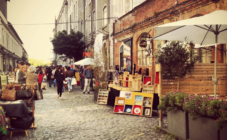
LX Factory: The new Lisbon
By Tensi Sánchez from actitudesmgz.com
Lisbon is changing. In it´s streets you can smell art and culture wherever you go. The new generations want to show to the rest of the world the greatness of the capital and the economical situation won´t be able to make the ilusion flater. LX Factory is the best example of how in times of crisis the best and most creative ideas can appear.
Alcantara was an industrial area in the XIX century located under the 25of April bridge, but nowadays this zone represents the hotest cultural area in the city. The 23.000 square meters space was meant to be demolished thanks to the Alcantara XXI project to turn it into a multipurpose area. But recession delayed the regeneration and Mainside agency took advantage of the decadent and industrial atmosphere, to rent corner for 12 euro the square meter for young artists and entrepeneurs.
The result? A huge space in which almost 80 companies related with culture, literature, art, fashion and design gather, to offer the most underground and Berlin style experience. The prizes are affordable and anybody can enjoy the hipster atmosphere.
The must places are the Cantina: an old workers dining room which incluyes food for vegetarians and or the breathtaking three floor Ler Devagar bookstore. In the night going to Lollipop disco it is a good option as long as you are included in the guests list. But there is always a chance to go to La Sala de las Columnas where different kinas of deejays will play music for a memorable night.
The Open day is an event which is held twice a year and organizates different workshops and expositions.
A different and magical place, that speaks for itself about a new Lisbon that is rosing form it´s ashes. A city that albergates the most contemporanean culture without leaving appart tradition.
By Tensi Sánchez from actitudesmgz.com
Photos by Ricardo Junqueira
Makes you want to go, right? Do it! Check out our prices here!
more info
Festival of Lights in Leipzig
Leipzig is known as the capital of German music, classic music artists such as Strauss, Wagner or Bach were closely attached to the city. Nevertheless, is also known for being part of an important moment in history, playing a key role on the fall of the Berlin wall, reason why the city is considered as the birthplace for the Peaceful Revolution.
On October 9th 1989, 70.000 Leipzig citizens demonstrate carrying candles around the Leipziger Ring calling for freedom to the Federal Republic of Germany. Despite several threats by the police to open fire, the demonstrations were peaceful and became an important milestone on the way to the fall of the Berlin Wall and German reunification.
From that date, every October 9th the Festival of Lights is celebrated to remember that important date, taking history to reality by using audio, video and light. On 2014, the 25th anniversary for the Pacific Revolution is celebrated and, as every year, the Festival of Lights in Leipzig sets the start for a long weekend were many cultural organizations dedicate events, exhibitions and concerts to remember the events on 1989. On 2009, for the 20th anniversary, almost 150.000 people joined a great parade around the city centre and Leipzig became a sea of lights. For 2014, numerous activities are expected around the festival.
Furthermore, on October 9-13th, 2014, Leipzig will celebrate a long week of cultural events and, throughout the year, visitors can follow the steps of these historical events and visit places such as the museum and the bunker in Stasi or the exhibition “Freiheit! Einheit! Denkmal!” (Freedom, unity, monument) – from September 24th, 2014 to January 4th, 2015 – in the Leipzig City Museum, where the historical memory remains to debate the future monument to freedom and unity.
Under the slogan “Fall 89 – Democracy arrival” Leipzig will transform the streets one more year in a light show and cultural celebration that you shouldn’t miss if you’re planning to visit the city.
Image from Philipp
Perfect plan to go with friends! Check our flights and sign up!
more info