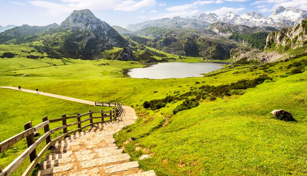
A 30.000 pies por viajeros para viajeros

Results

A piece of paradise on earth

Just when we land, Tenerife welcomes us with an air of mystery and legend. Its volcanic landscape and its uncertain origins, which some authors place in Atlantis are just two of its many attractions.

And, legends aside, what is clear is that more than a lucky island, Tenerife is a piece of paradise on earth. It has two World Heritage Sites, a National Park, 42 protected areas and its weather makes it the island of eternal spring.

Whether you are visiting the island with friends, with family or with children, Tenerife is one of those destinations where you want to come back.

National Park Cañadas del Teide and Puerto de la Cruz

One of the must visit of Tenerife is the Teide National Park. Its breathtaking volcanic landscapes achieved that, in 2007 Tenerife were included as Well Natural in the World Heritage List of UNESCO. It is possible to visit the park with different excursions including the popular camel rise.

The caldera and volcano Teide - Pico Viejo are some of the world's most spectacular geological monuments. It also has a variety of volcanic cones and domes, lava flows, tors and caves that form a range of colors and shapes.

From there you can descend through spectacular Orotava Valley to the north coast, where is located the village of Puerto de la Cruz. This small town has many tourist attractions such as Loro Park, the Botanical Gardens, Lake Martiánez pool complex, beach Garden and Plaza del Charco.

San Cristobal de la Laguna

The historic center of La Laguna form was declared a World Heritage Site by UNESCO and it is a joy to walk through its streets.

Worth a stop on the way the Cathedral of San Cristóbal de La Laguna, Neo-Gothic and houses an interesting and rich artistic heritage. A short walk in its streets, we find among other facades of stately homes in Plaza de la Concepción, in front of the church of the same name. Turning left from the Place de la Concepcion reaches Herradores street, completely pedestrian, other interesting examples of Canarian architecture. But if the rotation is clockwise, the tour ends in San Agustin Street, in the houses of the Jesuits, Montañéz and Salazar. Lercaro Palace, the Museum of History of Tenerife, is another milestone in the street of St. Augustine and the church and hospital of Our Lady of Sorrows, St. Augustine's Church and the Institute of the Canary Islands.

A little further away is the beautiful Royal Shrine of the Holy Christ, next to the Plaza de San Francisco, better known as the Christ.

Hiking and nature trails

Masca

Masca is a picturesque village situated on the northwest tip of the island in the Teno Massif within the rural park of the same name. In Masca can find stunning scenery with deep ravines and cliffs ending in the Atlantic Ocean, surrounded by greenery and roads with impossible curves. Reputed to have been a haven for pirates.

Cruz del Carmen

If what you like is walking, one of the oldest trails on the island is what leads us to the Cross of Carmen.This promenade runs for environment typical vegetation, wax myrtle, heather and some species typical of the laurel, and reaches the Llano de Los Loros, from where you can enjoy panoramic views of the north coast wide.

Whales and dolphins watching

The southwest coast of Tenerife is a privileged place for whale watching in the wild, since there are whales and dolphin colonies living here all year. His presence is so near the coast, which has turned Tenerife in the first place in Europe in importance by the number of people doing whale watching in freedom.

We can find up to 21 different species in these waters, from the blue whale to the fearsome giant orca. There are two resident populations, finned pilot whale and bottlenose dolphin, which can be seen almost 80% of the days of the year, with a rate close to 100% sighting.

And of course, the beaches!

On an island as privileged as Tenerife, we must visit its incredible beaches, whether you like volcanic sand as soft golden sand.

For lovers of tranquility we propose Bollullo beach, in the town of La Orotava. It is a beautiful and secluded beach of volcanic sand which had the extraordinary clean waters and relaxed atmosphere. It's a little crowded beach, ideal for those who want to escape the crowded tourist venues and enjoy some quiet time. Access to this beach is on foot by a stepped path surrounded by banana trees. Pay attention to swim in this beach, because it lacks containment boom wave.

And for those who prefer to enjoy all the tourist amenities, our recommendation goes to the beach nightgown and Duque Beach.

The nightdress is part of a continuous succession of beaches which are occasionally separated by a line of stones on sand. The swimming conditions are always optimal as a breakwater protects the currents and waves.

El Duque is a beach of fine golden sand beach located in the southern part of the island, surrounded by a lovely seafront promenade that connects more than 8 beaches. In calm waters, and an extension of nearly 700 meters, the Playa del Duque delights its visitors, for they have all the services of an environment where quality is more distinctive.

You can also enjoy other spectacular beaches like El Medano, El Socorro, The Arena, La Pinta, La Tejita, Teresitas or Las Vistas.

By Nadia Polo

Picture Las Teresitas by Sergio Martín González | Picture San Cristóbal de la Laguna by Jens Steckert | Picture Acantilado de los Gigantes by Daniel Gaínza

A place well worth discovering! Check out our flights here.

more info

Innsbruck – the Snow Paradise

Innsbruck is the paradise of snow-sliding sports enthusiasts. Here, one advantage is that the ski runs are just a stone’s throw from the city. Indeed, enthusiasts are treated to abundant white snow and blue skies. In other words, a dream come true for any skier, freerider, snowboarder or hiker worth their salt. The nine ski resorts in the Olympia SkiWorld Innsbruck are relished by skiing enthusiasts. Here, too, lies the Kühtai ski resort which, at an altitude of 2,020 metres, is the Alpine ceiling. Fortunately, Innsbruck is not only about snow-related activities. After a day on the pistes or hiking through the mountains, there is a host of options open to you, including the Christmas markets, of which there are no fewer than six here. But, this time we’re focusing on their resorts.

The Nine Ski Resorts Around the Three-time Olympic City

Olympia SkiWorld Innsbruck features a grand total of nine ski and snowboarding resorts, from family runs to pistes designated for professionals. Here you will find the right piste for you and moving between the different ski runs is facilitated by a free, eco-friendly ski bus.

1. Nordkette

This is one of the steepest pistes in Europe, with a gradient of 70%. The descent from Hafelekar to Seegrube is an experience for any adrenaline junkie. One of the features of this resort is that it is easily accessible by cableway or funicular from the city centre. At Seegrube there is also a chill-out area for those who prefer to swank around. This piste is very complete and includes a Kids Arena for the young ones. Nordketten Skylinepark also has night lighting and a 2,000-watt, surround musical system.

2. Patscherkofel

Located south of the city, the “gentle giant” faces the Nordkette mountain range. The runs on Mt Patscherkofel are three times Olympic (1964, 1976, 2012). Skiers can reach the pistes in comfort on the Olympia-Express and Patscherkofelbahn cableway, while freeriders will discover their own winter idyll at Snowpark Innsbruck.

3. Glungezer

Situated just 12 kilometres from Innsbruck and next door to Patscherkofel, the Glungezer ski station has pistes with panoramic views over the river Inn. It boasts the longest descent in Tyrol, stretching over 15 km. What’s more, as it lies further away from the city, it is less crowded than other spots.

4. Muttereralm

The Muttereralm ski resort is ideal for the whole family and is easily accessible from both Mutters and Götzens. Its attractive, sun-drenched ski slopes provide fantastic views over the Inntal and Wipptal valleys. Here you will find MAP 6020; in other words, the longest snowpark in the Innsbruck region.

5. Rangger Köpfl

A mere 15-minute car ride from Innsbruck, the Rangger Köpfl ski station has beginner- and intermediate-level pistes. A cable car with a capacity of 8, four ski lifts and a snowpark for beginners round off the amenities for ski lovers. The Höhenweg trail also enables hikers to enjoy the restorative Alpine winter air.

6. Axamer Lizum

The Axamer Lizum ski resort stands out for the quality of its pistes. Up to 12,000 people per hour can move about it, with practically no waiting times. With its north-facing slopes, this resort is a veritable paradise of powdered snow. Those game to go there are encouraged to eat at the Hoadlhaus panoramic restaurant.

7. Kühtai

Among the highest resorts in the Alps. Far from the other, crowded stations nearer the city, Kühtai has broad pistes and a guaranteed supply of snow until well into the spring. It also has numerous ski lifts, genuine Alpine shelters and night skiing twice a week. Further, K-Park Kühtai is a thrill for freeriders, as they can ski above the treeline.

8. Schlick 2000

The Schlick 2000 resort is all the rage in Alpine sport. Here, in the Stubaital valley, you can do downhill and cross-country skiing, carving, snowboarding, sleigh-riding, as well as walk in the snow or go paragliding. In the children’s section at the Ski School Stubai, tutors take care of children from the age of 3 months.

9. Stubai

The platform on top of the Stubai glacier affords views of a hundred and nine 3,000-metre summits, as well as over the giant glacier itself. Skiers have at their disposal 110 km of pistes and 25 ski lift systems in this, the largest glacier skiing resort in Austria, while Stubai Zoo is one of the best snowparks in Europe. The resort opens from October to June.

Further information at Innsbruck Tourismus. Why wait to discover the best snow experience on the continent? Check out our flights here.


Text by ISABELYLUIS Comunicación

Images by Innsbruck Tourismus

more info

A Natural Hike Through Asturias – From Reserve to Reserve

If there’s one striking thing about Asturias it is the beauty of its landscape – the power of nature here. Asturias is, above all, nature in its pure state, but imbued with a deep-rooted awareness of environmental conservation, making it emblematic and pioneering in its drive to preserve its natural surroundings. This is why a third of its surface area is protected by one or other legal conservation provision, making it a veritable nature paradise, as proclaimed by the slogan which has now been running for thirty years.

Asturias is one great open-air nature park, unique in the world. Not for nothing does it boast six Biosphere Reserves, as listed by UNESCO, making it one of the world’s privileged territories in terms of natural spaces. These are the spaces to be hiked and enjoyed in your leisure time.

The Parque Nacional de los Picos de Europa, set in the Cordillera Cantábrica mountain range: this vast territory encompasses the areas of Amieva, Cangas de Onís, Onís, Cabrales, Peñamellera Alta and Peñamellera Baja. Its uniqueness, beauty and scenic, natural and geological interest led this territory to be declared the Picos de Europa National Park by King Alfonso XIII in 1918, while its western reaches once formed the first national park in Spain, that of Montaña de Covadonga. The Picos de Europa are the largest limestone formation on Europe’s Atlantic seaboard, featuring major karst processes – a type of relief set up by chemical meteorisation of certain rocks, notably limestone, dolomite and gypsum – chasms over 1,000 metres deep, pronounced glacial erosion and the presence of lakes. Here, chamois roam the crags, while the dense forest is home to roe deer, wolves and the occasional bear. The Park also boasts over a thousand bird species, prominent among which are the black woodpecker and capercaillie, with the griffon vulture and golden eagle as the major birds of prey. But, here you will find more than just nature, as centuries of history have been written in the villages, valleys and churches, in the mountain pass shelters and trails.

The Parque Natural de Somiedo is a distinct example of coexistence between man and nature, where the former has come to understand nature and preserve it virtually intact over the centuries. Noteworthy landmarks here are the beautiful lakes, the rugged landscape, with drops of up to 2,200 metres, and the karst formations. Significant, too, are the brañas, fertile pasturelands where you might just get a glimpse of the famous cabanas de teito – stone dwellings with thatched straw or broom roofs used by thevaqueiros or mountain cowherds and stock breeders as shelters.

The environmental wealth of the Parque Natural de Redes is attested by a host of different landscapes, from formations of glacial origin such as moraine and cirques to broad pasturelands, hills and lush forests. In effect, 40% of the surface area of Redes is wooded, although it is also graced by lofty peaks, notably Pico Torres, Retriñón, Peña del Viento and Tiatordos. However, the most striking feature of Redes is its stunning meadows hemmed in by mountain buttresses, its gorges and its forests, where beech and white oak prevail.

The Parque Natural de Las Ubiñas-La Mesa, situated in southern and central Asturias, harbours priceless natural and cultural wealth. It includes mountain relief with marked contrasts which, hard by the border with León, rises to the Peña Ubiña massif, the second highest mountain range in the region after the Picos de Europa, with altitudes of over 2,400 metres. The Park takes in the municipalities of Lena, Quirós and Teverga which form part of the Somiedo Regional Hunting Preserve.

The Reserva Natural Integral de Muniellos lies within the Parque Natural de las Fuentes del Narcea y del Ibias. Muniellos is a sparsely populated territory, with one of the lowest population densities in Asturias. Its three valleys of Muniellos, La Viliella and Valdebois boast Spain’s largest oak forest and one of the best preserved in Europe. Ever-changing, it epitomises the Asturian landscape throughout the seasons of the year – various species of oak, up to six metres in diameter, beech and birch forest, dotted with holly and yew trees, the evergreen kings of autumn in Muniellos. The ascent to its lakes is one of the most popular trails among hiking enthusiasts.

The Oscos-Eo District, where the river Eo is the great protagonist as landscape-builder and articulator of the territory. A land of beaches, cliffs, forests and enormous ethnographic wealth, a landscape which has suffered the consequences of centuries-long isolation but has nevertheless provided the bedrock for sustainability and rural tourism projects in which preservation of the local heritage is uppermost in their development.

Asturias, from Biosphere Reserve to Biosphere Reserve, is a great option for a relaxing getaway. You can also make the most of its boundless nature by participating in dozens of open-air activities: canoeing, horse-riding, mountain bike trails, caving, canyoning and trekking, just some of the ways of immersing yourself in this paradise.

Don’t miss out on this paradise on earth – check out our flights here.

Text and images by Turismo Asturias


more info

Ghosts Of London's Past

Por Michael Schuermann de Easy Hiker

London is a great city for hikers. For one because there are so many scenic trails and nature reserves near-by – the Ridgeway, the South Downs Way, the New Forest – and for another because they are all so easy and convenient to reach by what is probably the world’s best public transport system. (I know the London urban and suburban rail networks get a lot of stick, but I still have to find another city in the world where it is as easy to get around even if you have no car.)

We will spend more time in London in the near future and intend to explore the walking trails of the area in some detail, although the more serious hiking trips will have to wait until the spring.

For the time being, however, we will keep things simple and start you off this week with two short walksalong the Thames, one in the east and one in the west, each roughly two to three hours long, allowing you to set out late, after a leisurely breakfast on a weekend for example, and still be back in time “for tea” to watch the afternoon soccer game “on the telly”. Are you still with me, “guv”?

Ghosts of London Past

Wapping in the east of the city has always been my favourite part of “walking London”. I have done this walk several times over the past twenty years or so, but it was never the same walk – because the area has changed and still changes so quickly.

This stretch of London – between the Tower and Greenwich – was once the most important hub of global trade, the place where shiploads after shiploads of coffee, tobacco and sugar from the British colonies arrived on their way to the European consumers.

The London docks were abandoned in the 1960s, and the area lay fallow, a barren industrial wasteland, for twenty years before it was redeveloped in the 1980s. When I came here first, a little over twenty years ago, this process was still very much ongoing, and the “docklands” at the time were a surreal blend of derelict industrial buildings, waste dumps, modern office developments and handsome 19th century mansions.

Nowadays, the docklands are very trendy and chic, but they are still nothing like similarly trendy and chic areas of West London. They are, for one, much less lively. Wapping High Street is a residential area, but when we went there, on a Saturday around lunchtime, we were almost the only people in the street, give or take the odd jogger. Between old warehouses, centuries-old taverns and narrow stairways that lead down to the river, you feel that ghosts are walking with you every step of the way.

Our walk starts at St. Katharine Docks in the back of Tower Hill station. Walk down the stairs on your left hand side, turn left in front of the moat of the Tower of London and simply follow the signs.

The three basins of St. Katharine Docks were developed in the 1820s when one of the largest London slums – with over 10,000 inhabitants – was razed to the ground. (The rubble of the destroyed dwellings, ironically, was used to lay the foundations for one of London’s most luxurious property development projects in Belgravia.)

The St. Katharine Docks were never a great commercial success – the gates to the river Thames were too narrow, preventing larger ships from entering – and, having been heavily bombed in WWII, never fully rebuilt and gradually abandoned.

They became, however, also the first of the London docks to be redeveloped as a leisure-plus-retail facility and the blueprint for all such projects since, in the capital and all across Britain. They are a very pretty sight indeed, particularly on a sunny day. (Unfortunately, we were not quite so lucky on our walk.)

Leave St. Katharine Docks in the back of the Dickens Inn through Thomas More Street and turn left into Wapping High Street along the Thames. Look out for Wapping Pier Head, two early 19th century brick buildings that were erected right on the entrance to the docks to accommodate leading dock officials and their families …

… and, a few houses down the road, the ancient Town of Ramsgate pub. The Wapping Old Stairs beside the pub – they lead down to the river – are said to be haunted: for many men, convicts on their way to Australia and drunks who were imprisoned in the pub’s cellar before being “press-ganged” into the navy, these stairs would have been the last things they ever saw of England.

A little further on, in the garden next to the modern HQ of the London River Police, the City of London used to execute pirates – not removing their bodies before three high tides had washed over them, as a kind of deterrent presumably. The infamous Captain Kidd was hanged here in 1701, and a couple of blocks down, there is a pub that was named in his honour. (Go check it out. It has stunning views over the Thames.)

Continue past some more old warehouses before turning right into Wapping Wall – look for London’s oldest riverside pub, the Prospect of Whitby – and crossing the bridge into Shadwell. (Another modern development, called Shadwell Basin, appears on your left.)

Immediately after the bridge, turn right in the direction of King Edward VII Memorial Park, and continue by the bank of the river with some spectacular views of Canary Wharf in the distance.

Turn left into Spert Street for Limehouse Basin, where this walk ends. There is a DLR station on your left hand side from where the trains of the “Docklands Light Railway” take you back into the centre of London within a few minutes.

By Michael Schuermann de Easy Hiker 

Does this make you want to go? Do it! Check out our prices here!


more info